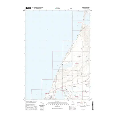
2014 Map of Parkdale
USGS Topo · Published 2014About this map
Manistee and its surrounding water-defined landscape dominate this coastal survey along the shores of Lake Michigan. The map illustrates the complex hydrology where the Manistee River meets Manistee Lake, a sheltered harbor that fostered the development of Eastlake and Parkdale. These shoreline communities are tied together by a network of modern thoroughfares like the Chippewa Hwy and Caberfae Hwy, which intersect near the Manistee County-Blacker Airport.
Find a feature on this map
51 named features on this map. Tap any name to fly to it.
Don’t see what you’re looking for? This feature index may not catch every label — zoom into the map to look around manually.
Map Details
Editions of this 2014 Parkdale Map
This is the sole edition of this map. No revisions or reprints were ever made.
Other maps of this area

1954 · Manitowoc
USGS Topo · 1:250,000

1956 · Onekama
USGS Topo · 1:62,500

1956 · Bar Lake
USGS Topo · 1:62,500

1957 · Freesoil
USGS Topo · 1:62,500

1958 · Manitowoc
USGS Topo · 1:250,000

1958 · Manistee
USGS Topo · 1:62,500

1976 · Onekama NW
USGS Topo · 1:24,000

1976 · Onekama SW
USGS Topo · 1:24,000
1976 · Bar Lake SE
USGS Topo · 1:24,000
1982 · Onekama
USGS Topo · 1:25,000