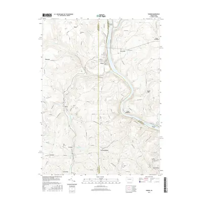
2016 Map of Parker
USGS Topo · Published 2016About this map
The Allegheny River and Clarion River converge at the northern edge of this 2016 survey, defining a landscape marked by steep river valleys and historical cemetery sites. At the center of the terrain, Parker sits on the riverbanks, serving as a focal point near the Grand Army of the Republic Cem and Parker Presbyterian Cem. The map illustrates a dense network of smaller settlements such as Petrolia, Bruin, and Karns City to the south, while the N Country National Scenic Trail winds through the hills. This modern record details the intricate geography of the region, including notable landforms like Clarion Island and Black Fox Island. Water management is evident through features like the Number Three Reservoir near Fredericksburg, while numerous family and church burial grounds, including the Saints Peter and Paul Cem and Shakley Cem, provide significant data for local historians and genealogists.
Find a feature on this map
135 named features on this map. Tap any name to fly to it.
Don’t see what you’re looking for? This feature index may not catch every label — zoom into the map to look around manually.
Map Details
Editions of this 2016 Parker Map
This is the sole edition of this map. No revisions or reprints were ever made.
Other maps of this area

1900 · Kittanning
USGS Topo · 1:62,500

1902 · Kittanning
USGS Topo · 1:62,500

1907 · Foxburg
USGS Topo · 1:62,500

1908 · Foxburg
USGS Topo · 1:62,500

1909 · Butler
USGS Topo · 1:62,500

1910 · Hilliards
USGS Topo · 1:62,500

1911 · Butler
USGS Topo · 1:62,500

1912 · Hilliards
USGS Topo · 1:62,500

1944 · Hilliards
USGS Topo · 1:62,500

1953 · Pittsburgh
USGS Topo · 1:250,000