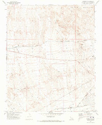
1970 Map of Parker NW
USGS Topo · Published 1973About this map
The Whipple Mountains dominate the northern landscape of this California desert region, where industrial infrastructure and remote mining claims define the terrain. Engineering feats of the mid-20th century are clearly visible through the winding path of the Colorado River Aqueduct, which cuts across the central portion of the sheet. To the south, the settlement of Calzona sits along the Atchison Topeka and Santa Fe railroad, serving as a rare point of habitation in the Vidal Valley.
Find a feature on this map
20 named features on this map. Tap any name to fly to it.
Don’t see what you’re looking for? This feature index may not catch every label — zoom into the map to look around manually.
Map Details
Editions of this 1970 Parker NW Map
2 editions found
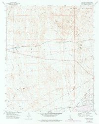
Other maps of this area

1911 · Parker
USGS Topo · 1:125,000

1943 · Whipple Mts.
USGS Topo · 1:62,500

1943 · Parker
USGS Topo · 1:62,500

1943 · Vidal
USGS Topo · 1:62,500

1949 · Parker
USGS Topo · 1:62,500

1949 · Vidal
USGS Topo · 1:62,500

1950 · Parker
USGS Topo · 1:62,500

1950 · Vidal
USGS Topo · 1:62,500

1950 · Whipple Mts
USGS Topo · 1:62,500

1950 · Savahia Peak
USGS Topo · 1:62,500