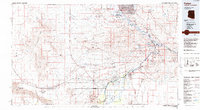
1985 Map of Parker
USGS Topo · Published 1985About this map
Lake Havasu City and the expanding reach of the Colorado River define this mid-1980s landscape at the Arizona-California border. The map documents the critical infrastructure of the era, from the Gene Wash Reservoir and Copper Basin Reservoir to the Atchison Topeka and Santa Fe railroad corridor. Mining remains a visible legacy across the desert peaks, with sites like the War Eagle No 1 Mine, American Eagle Mine, and Gold Standard Mine punctuating the Whipple Mountains.
Find a feature on this map
110 named features on this map. Tap any name to fly to it.
Don’t see what you’re looking for? This feature index may not catch every label — zoom into the map to look around manually.
Map Details
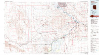
Editions of this 1985 Parker Map
2 editions found
Other maps of this area

1903 · Needles
USGS Topo · 1:125,000

1904 · Needles Special
USGS Topo · 1:125,000

1911 · Parker
USGS Topo · 1:125,000

1923 · Signal
USGS Topo · 1:250,000

1927 · Buck Mountains
USGS Topo · 1:62,500

1929 · Buck Mountains
USGS Topo · 1:62,500

1930 · Linskey
USGS Topo · 1:62,500

1931 · Moon Mtn
USGS Topo · 1:62,500

1932 · Moon Mtn
USGS Topo · 1:62,500

1942 · Signal
USGS Topo · 1:250,000