
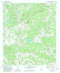
1971 Map of Parkers Crossroads
USGS Topo · Published 1973About this map
Lee County State Lake sits at the heart of this landscape east of Opelika, where the rolling terrain of Lee County is defined by a dense network of creeks and small rural communities. The area, surveyed in the late 1960s and early 1970s, reveals a traditional Southern settlement pattern anchored by crossroads and country churches. Local history is deeply embedded in sites like Parkers Crossroads and Spring Villa, while the industrial past is visible through Griffen Mill and Meadows Mill along Little Uchee Creek. The Central of Georgia railway cuts through the northern section, passing Morris Chapel Cem and the outskirts of the county seat. Numerous smaller drainages including Chewacla Creek and Snake Creek underscore the agricultural and hydrological character of the region during this era.
Find a feature on this map
47 named features on this map. Tap any name to fly to it.
Don’t see what you’re looking for? This feature index may not catch every label — zoom into the map to look around manually.
Map Details
Editions of this 1971 Parkers Crossroads Map
2 editions found
Other maps of this area

1907 · Opelika
USGS Topo · 1:125,000

1909 · Opelika
USGS Topo · 1:125,000

1914 · Seale
USGS Topo · 1:62,500

1950 · Crawford
USGS Topo · 1:24,000

1950 · Seale
USGS Topo · 1:62,500

1955 · Crawford
USGS Topo · 1:24,000

1955 · Seale
USGS Topo · 1:62,500

1955 · Phenix City
USGS Topo · 1:250,000

1957 · Phenix City
USGS Topo · 1:250,000

1958 · Phenix City
USGS Topo · 1:250,000