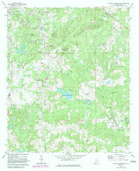
1971 Map of Parkers Crossroads
USGS Topo · Published 1984About this map
Lee County Public Lake serves as a central landmark in this rural landscape east of Opelika, where the topography is defined by the headwaters of Uchee Creek and its many tributaries. The area maintains a strong agricultural and early industrial character, evidenced by the presence of Griffen Mill and Meadows Mill along the southern watercourses. The Central of Georgia railroad cuts through the northern section, connecting the regional hub of Opelika to outlying settlements like Spring Villa. Numerous community centers are anchored by historic congregations and burial grounds, including Shiloh Ch Cem, Providence Ch, and Pleasant Hill Ch Cem. The landscape is further marked by local industry such as several Gravel Pit sites and a Quarry, illustrating the transition from traditional milling to modern resource extraction by the early 1970s.
Find a feature on this map
46 named features on this map. Tap any name to fly to it.
Don’t see what you’re looking for? This feature index may not catch every label — zoom into the map to look around manually.
Map Details
Editions of this 1971 Parkers Crossroads Map
2 editions found

Other maps of this area

1907 · Opelika
USGS Topo · 1:125,000

1909 · Opelika
USGS Topo · 1:125,000

1914 · Seale
USGS Topo · 1:62,500

1950 · Crawford
USGS Topo · 1:24,000

1950 · Seale
USGS Topo · 1:62,500

1955 · Crawford
USGS Topo · 1:24,000

1955 · Seale
USGS Topo · 1:62,500

1955 · Phenix City
USGS Topo · 1:250,000

1957 · Phenix City
USGS Topo · 1:250,000

1958 · Phenix City
USGS Topo · 1:250,000