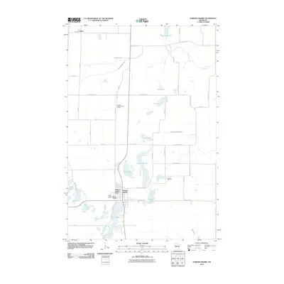
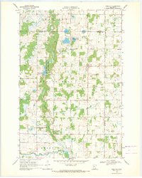
2010 Map of Parkers Prairie
USGS Topo · Published 2010About this map
Parkers Prairie serves as the central hub of this Otter Tail County landscape, where the town grid meets a chain of glacial lakes and managed waterways. The settlement is flanked by several significant burial sites, including Parkers Prairie Cemetery and Saint Williams Cemetery, which provide essential points of reference for genealogical research in the area. To the north, the smaller settlement of Almora sits near the edge of the survey area, connected by a network of rural roads that navigate around features like Almora Lake and Curtis Lake.
Find a feature on this map
15 named features on this map. Tap any name to fly to it.
Don’t see what you’re looking for? This feature index may not catch every label — zoom into the map to look around manually.
Map Details
Editions of this 2010 Parkers Prairie Map
This is the sole edition of this map. No revisions or reprints were ever made.
Other maps of this area

1953 · Brainerd
USGS Topo · 1:250,000

1957 · Brainerd
USGS Topo · 1:250,000

1958 · Brainerd
USGS Topo · 1:250,000

1965 · Brainerd
USGS Topo · 1:250,000
1969 · Lake Miltona West
USGS Topo · 1:24,000
1969 · Lake Miltona East
USGS Topo · 1:24,000

1969 · Henning
USGS Topo · 1:24,000
1969 · Parkers Prairie NW
USGS Topo · 1:24,000

1969 · Henning SE
USGS Topo · 1:24,000
1969 · Rose City
USGS Topo · 1:24,000
Featured Places
- Parkers Prairie, MN
- Eastern Township, MN
- Parkers Prairie Park, Parkers Prairie
- Elmo Township, MN
- Parkers Prairie Township, MN