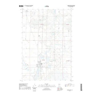
2019 Map of Parkers Prairie
USGS Topo · Published 2019About this map
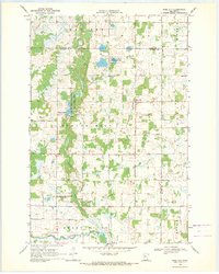
Parkers Prairie serves as the central hub of this prairie landscape, where the local road network converges at the intersection of W Main St and Parkers Rd. The area is defined by a dense concentration of glacial lakes and wetlands, ranging from the prominent Lake Adley at the town's southern edge to smaller bodies like Cora Lake and Augusta Lake. This 2019 survey documents a landscape where agricultural drainage is managed through systems like County Ditch Number Four and County Ditch Number Nineteen, which feed into the meandering Wing River to the northeast. To the north, the small settlement of Almora sits along Co HWY 40. For local historians, the map preserves the exact locations of significant community sites, including the Gausdale Lutheran Church and its accompanying Gausdale Lutheran Cem, alongside the Swedish Cem further east.
Find a feature on this map
43 named features on this map. Tap any name to fly to it.
Don’t see what you’re looking for? This feature index may not catch every label — zoom into the map to look around manually.
Map Details
Editions of this 2019 Parkers Prairie Map
This is the sole edition of this map. No revisions or reprints were ever made.
Other maps of this area

1953 · Brainerd
USGS Topo · 1:250,000

1957 · Brainerd
USGS Topo · 1:250,000

1958 · Brainerd
USGS Topo · 1:250,000

1965 · Brainerd
USGS Topo · 1:250,000
1969 · Lake Miltona West
USGS Topo · 1:24,000
1969 · Lake Miltona East
USGS Topo · 1:24,000

1969 · Henning
USGS Topo · 1:24,000
1969 · Parkers Prairie NW
USGS Topo · 1:24,000

1969 · Henning SE
USGS Topo · 1:24,000
1969 · Rose City
USGS Topo · 1:24,000
Featured Places
- Parkers Prairie, MN
- Eastern Township, MN
- Parkers Prairie Park, Parkers Prairie
- Elmo Township, MN
- Parkers Prairie Township, MN