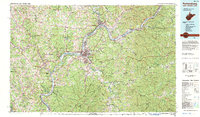
1981 Map of Parkersburg
USGS Topo · Published 1984About this map
The Ohio River serves as the central artery for this 1980s-era map, dictating the development of border towns in both West Virginia and Ohio. At the confluence of the Muskingum River, the city of Marietta anchor the northern reaches, while Parkersburg dominates the center near the historical Blennerhassett Island. The landscape is a complex network of ridgelines and watercourses, including New England Ridge and the winding Little Kanawha River.
Find a feature on this map
203 named features on this map. Tap any name to fly to it.
Don’t see what you’re looking for? This feature index may not catch every label — zoom into the map to look around manually.
Map Details
Editions of this 1981 Parkersburg Map
This is the sole edition of this map. No revisions or reprints were ever made.
Other maps of this area

1893 · Sutton
USGS Topo · 1:125,000

1902 · Parkersburg
USGS Topo · 1:62,500

1903 · Macksburg
USGS Topo · 1:62,500

1903 · Athens
USGS Topo · 1:62,500

1904 · Parkersburg
USGS Topo · 1:62,500

1904 · Marietta
USGS Topo · 1:62,500

1904 · Chesterhill
USGS Topo · 1:62,500

1905 · Athens
USGS Topo · 1:62,500

1905 · West Union
USGS Topo · 1:62,500

1905 · New Matamoras
USGS Topo · 1:62,500