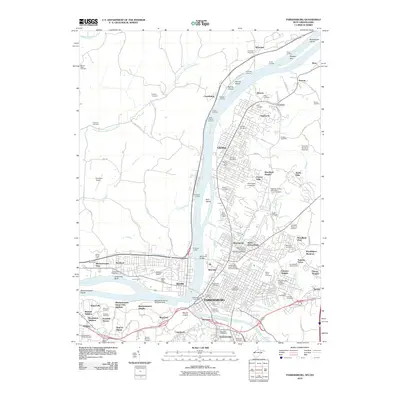
2010 Map of Parkersburg
USGS Topo · Published 2010About this map
Parkersburg and Vienna occupy the eastern banks of the Ohio River in this detailed 2010 survey, showing the complex industrial and educational landscape of the Mid-Ohio Valley. The map captures the significant presence of higher education at Ohio Valley University and the West Virginia University Parkersburg Branch. Across the water in Ohio, Belpre and Rockland are connected to the West Virginia side by the Memorial Bridge, while the West Parkersburg Seaplane Base reflects the area's specialized transportation history along the riverfront.
Find a feature on this map
118 named features on this map. Tap any name to fly to it.
Don’t see what you’re looking for? This feature index may not catch every label — zoom into the map to look around manually.
Map Details
Editions of this 2010 Parkersburg Map
This is the sole edition of this map. No revisions or reprints were ever made.
Other maps of this area

1902 · Parkersburg
USGS Topo · 1:62,500

1904 · Parkersburg
USGS Topo · 1:62,500

1904 · Marietta
USGS Topo · 1:62,500

1906 · Elizabeth
USGS Topo · 1:62,500

1906 · Belleville
USGS Topo · 1:62,500

1924 · Belleville
USGS Topo · 1:62,500

1924 · Marietta
USGS Topo · 1:62,500

1924 · Elizabeth
USGS Topo · 1:62,500

1926 · Elizabeth
USGS Topo · 1:62,500

1926 · Belleville
USGS Topo · 1:62,500