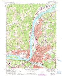
2023 Map of Parkersburg
USGS Topo · Published 2023About this map
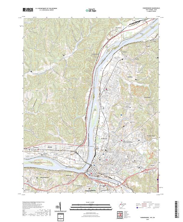
Blennerhassett Island Historical State Park sits at the confluence of the Ohio River and the Little Kanawha River, serving as a central point for this urban and riverfront landscape. The city of Parkersburg and neighboring Vienna dominate the West Virginia bank, characterized by a dense network of residential streets and numerous historic burial grounds such as Mount Olivet Cem and Saint Francis Xavier Catholic Cem. Across the river in Ohio, the communities of Belpre and Rockland are connected by industrial corridors and the CSX Transportation line. The map highlights the region's reliance on the waterways, featuring the Ohio River Water Trail and the Little Kanawha Water Trail, while inland, Barnett Ridge and Mount Logan provide topographic relief to the otherwise developed valley floor.
Find a feature on this map
169 named features on this map. Tap any name to fly to it.
Don’t see what you’re looking for? This feature index may not catch every label — zoom into the map to look around manually.
Map Details
Editions of this 2023 Parkersburg Map
This is the sole edition of this map. No revisions or reprints were ever made.
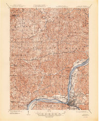
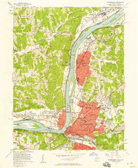
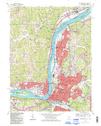
Historical Maps of Beechwood Through Time
7 maps found