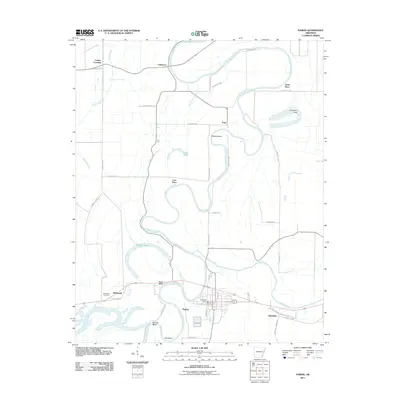
2011 Map of Parkin
USGS Topo · Published 2011About this map
The Saint Francis River and its intricate network of sloughs and bends dominate this corner of eastern Arkansas. The landscape is defined by the river's winding path, creating distinctive terrain features like Woods Bend, Short Bend, Barrow Bend, and Ash Bend. Along these waterways, a series of named locales suggest a history of family landings and rural crossroads, including Yarbo Place, Love Place, and Colton Crossing.
Find a feature on this map
51 named features on this map. Tap any name to fly to it.
Don’t see what you’re looking for? This feature index may not catch every label — zoom into the map to look around manually.
Map Details
Editions of this 2011 Parkin Map
This is the sole edition of this map. No revisions or reprints were ever made.
Other maps of this area

1939 · Edmondson
USGS Topo · 1:62,500

1940 · Deckerville
USGS Topo · 1:62,500

1940 · Princedale
USGS Topo · 1:62,500

1940 · Whitmore
USGS Topo · 1:62,500

1953 · Memphis
USGS Topo · 1:250,000

1954 · Edmondson
USGS Topo · 1:62,500

1956 · Memphis
USGS Topo · 1:250,000

1956 · Whitmore
USGS Topo · 1:62,500

1956 · Princedale
USGS Topo · 1:62,500

1957 · Deckerville
USGS Topo · 1:62,500