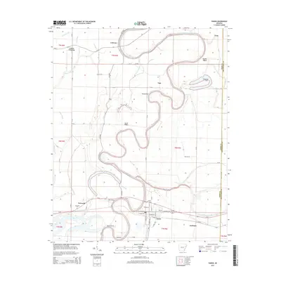
2014 Map of Parkin
USGS Topo · Published 2014About this map
Parkin sits at the southern edge of this Mississippi Delta landscape, defined by the winding course of the Saint Francis River and the Tyronza River. The terrain is characterized by intricate river meanders and bayous, including Sycamore Slough and Wolf Slough, which weave through the agricultural land. Smaller settlements and named locations such as Togo, Twist, and Coldwater are scattered across the quadrangle, reflecting the rural township and range system. Notable landmarks for local historians include the McDonald Cem near the McDonald settlement and several family-named locations such as Yarbo Place and Love Place. Significant water features like Pemiscot Lake and Barnes Lake highlight the low-lying, water-rich environment of Cross County near the Crittenden County line.
Find a feature on this map
60 named features on this map. Tap any name to fly to it.
Don’t see what you’re looking for? This feature index may not catch every label — zoom into the map to look around manually.
Map Details
Editions of this 2014 Parkin Map
This is the sole edition of this map. No revisions or reprints were ever made.
Other maps of this area

1939 · Edmondson
USGS Topo · 1:62,500

1940 · Deckerville
USGS Topo · 1:62,500

1940 · Princedale
USGS Topo · 1:62,500

1940 · Whitmore
USGS Topo · 1:62,500

1953 · Memphis
USGS Topo · 1:250,000

1954 · Edmondson
USGS Topo · 1:62,500

1956 · Memphis
USGS Topo · 1:250,000

1956 · Whitmore
USGS Topo · 1:62,500

1956 · Princedale
USGS Topo · 1:62,500

1957 · Deckerville
USGS Topo · 1:62,500