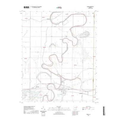
2020 Map of Parkin
USGS Topo · Published 2020About this map
The Saint Francis River snakes through this portion of Cross County, defining a landscape of dramatic oxbows and river bends like Woods Bend, Short Bend, and Barrow Bend. At the heart of the region, the city of Parkin is situated near the confluence of the river and Parkin Slough, neighboring the significant Parkin Archeological State Park. This area preserves a Mississippian-era site, with the Parkin Archeological State Park Cem and Parkin Cem located within its vicinity.
Find a feature on this map
64 named features on this map. Tap any name to fly to it.
Don’t see what you’re looking for? This feature index may not catch every label — zoom into the map to look around manually.
Map Details
Editions of this 2020 Parkin Map
This is the sole edition of this map. No revisions or reprints were ever made.
Other maps of this area

1939 · Edmondson
USGS Topo · 1:62,500

1940 · Deckerville
USGS Topo · 1:62,500

1940 · Princedale
USGS Topo · 1:62,500

1940 · Whitmore
USGS Topo · 1:62,500

1953 · Memphis
USGS Topo · 1:250,000

1954 · Edmondson
USGS Topo · 1:62,500

1956 · Memphis
USGS Topo · 1:250,000

1956 · Whitmore
USGS Topo · 1:62,500

1956 · Princedale
USGS Topo · 1:62,500

1957 · Deckerville
USGS Topo · 1:62,500