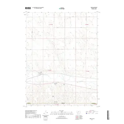
2017 Map of Parks
USGS Topo · Published 2017About this map
Parks sits prominently along the north bank of the Republican River in this 2017 study of southwest Nebraska. The settlement’s street grid, including Pringle St, Phelan St, and Ewing St, is clearly defined near the river's path, with the Parks Cem located to the northwest. The surrounding topography is defined by a dense network of watercourses and dry canyons that feed into the river valley. Numerous named drainages, such as Horse Cr and Rock Cr, carve through the terrain, while the southern portion of the quadrangle near the Nebraska Kansas state line features prominent landforms like Will Stafford Canyon, Jarvis Canyon, and Barlett Canyon. This landscape reveals a complex system of erosion and drainage, with Smute Canyon and Smutz Canyon marking the descent toward the state border between Dundy Co and Cheyenne Co.
Find a feature on this map
27 named features on this map. Tap any name to fly to it.
Don’t see what you’re looking for? This feature index may not catch every label — zoom into the map to look around manually.
Map Details
Editions of this 2017 Parks Map
This is the sole edition of this map. No revisions or reprints were ever made.
Other maps of this area

1942 · St. Francis
USGS Topo · 1:62,500

1943 · St. Francis
USGS Topo · 1:62,500

1951 · St Francis
USGS Topo · 1:62,500

1951 · Bird City North
USGS Topo · 1:62,500

1954 · McCook
USGS Topo · 1:250,000

1954 · Goodland
USGS Topo · 1:250,000

1956 · Goodland
USGS Topo · 1:250,000

1957 · McCook
USGS Topo · 1:250,000

1957 · Goodland
USGS Topo · 1:250,000

1958 · McCook
USGS Topo · 1:250,000