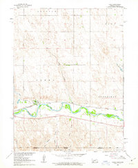
1961 Map of Parks
USGS Topo · Published 1963About this map
The Republican River valley defines this early 1960s landscape, where irrigation and rail transportation meet at the settlement of Parks. The Chicago Burlington and Quincy railroad parallels the river, serving as the primary corridor through the south-central portion of the quadrangle. This area was mapped as part of a Department of the Interior program focused on the development of the Missouri River Basin, capturing the agricultural layout of Dundy County just before modern irrigation techniques further transformed the High Plains.
Find a feature on this map
25 named features on this map. Tap any name to fly to it.
Don’t see what you’re looking for? This feature index may not catch every label — zoom into the map to look around manually.
Map Details
Editions of this 1961 Parks Map
This is the sole edition of this map. No revisions or reprints were ever made.
Other maps of this area

1942 · St. Francis
USGS Topo · 1:62,500

1943 · St. Francis
USGS Topo · 1:62,500

1951 · St Francis
USGS Topo · 1:62,500

1951 · Bird City North
USGS Topo · 1:62,500

1954 · McCook
USGS Topo · 1:250,000

1954 · Goodland
USGS Topo · 1:250,000

1956 · Goodland
USGS Topo · 1:250,000

1957 · McCook
USGS Topo · 1:250,000

1957 · Goodland
USGS Topo · 1:250,000

1958 · McCook
USGS Topo · 1:250,000