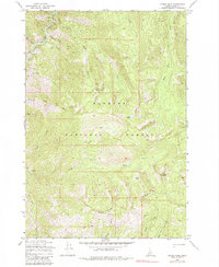
1969 Map of Parks Peak
USGS Topo · Published 1984About this map
The South Fork Salmon River cuts through the northwest corner of this remote Idaho landscape, setting the drainage pattern for a complex network of high-elevation creeks. As part of the Payette National Forest, the area is defined by significant topographical landmarks like Parks Peak and the high spine of Rainbow Ridge. The map shows a landscape largely untouched by major development, where movement is dictated by a Pack Trail and a limited Jeep Trail network.
Find a feature on this map
27 named features on this map. Tap any name to fly to it.
Don’t see what you’re looking for? This feature index may not catch every label — zoom into the map to look around manually.
Map Details
Editions of this 1969 Parks Peak Map
3 editions found

Other maps of this area

1937 · Yellow Pine
USGS Topo · 1:48,000

1937 · Big Creek
USGS Topo · 1:48,000

1942 · Big Creek
USGS Topo · 1:62,500

1943 · Yellow Pine
USGS Topo · 1:62,500

1956 · Elk City
USGS Topo · 1:250,000

1957 · Challis
USGS Topo · 1:250,000

1960 · Elk City
USGS Topo · 1:250,000

1960 · Challis
USGS Topo · 1:250,000

1963 · Challis
USGS Topo · 1:250,000

1969 · Profile Gap
USGS Topo · 1:24,000