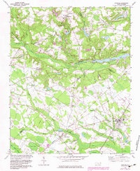
1972 Map of Parkton
USGS Topo · Published 1983About this map
Lumber Bridge and Parkton serve as the primary hubs in this corner of North Carolina, where the railroad industry dictates the landscape's rhythm. The Seaboard Coast Line and Aberdeen and Rockfish railroads intersect here, passing through smaller stopovers like McNatts Sta. This transit-oriented layout is interspersed with numerous rural congregations and landmarks, including Pittman Grove Ch, Rock Grove Ch, and the Parkton Lookout Tower.
Find a feature on this map
52 named features on this map. Tap any name to fly to it.
Don’t see what you’re looking for? This feature index may not catch every label — zoom into the map to look around manually.
Map Details
Editions of this 1972 Parkton Map
2 editions found
Other maps of this area

1948 · Fayetteville
USGS Topo · 1:62,500

1948 · Clifdale
USGS Topo · 1:62,500

1948 · Nicholson Creek
USGS Topo · 1:24,000

1948 · Clifdale
USGS Topo · 1:24,000

1950 · Clifdale
USGS Topo · 1:24,000

1950 · Fayetteville
USGS Topo · 1:24,000

1950 · Nicholson Creek
USGS Topo · 1:24,000

1951 · Clifdale
USGS Topo · 1:62,500

1953 · Florence
USGS Topo · 1:250,000

1953 · Raleigh
USGS Topo · 1:250,000