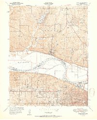
1951 Map of Parkville
USGS Topo · Published 1951About this map
Parkville sits prominently along the north bank of the Missouri River, anchoring a landscape where the river’s sweeping bends dictate the shape of development. The educational character of the region is defined by Park College in Missouri and the grounds of Western University across the water in Kansas. North of the river, the mid-century expansion is visible in residential developments like Platte Woods and Northwood Acres, clustered around new water bodies such as Weatherby Lake and Lake Waukomis. The terrain is deeply incised by drainages like White Aloe Branch and Brush Creek, forcing roads and settlements to follow the high ridges.
Find a feature on this map
78 named features on this map. Tap any name to fly to it.
Don’t see what you’re looking for? This feature index may not catch every label — zoom into the map to look around manually.
Map Details
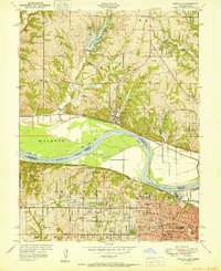
Editions of this 1951 Parkville Map
2 editions found
Other maps of this area

1890 · Kansas City
USGS Topo · 1:125,000

1894 · Kansas City
USGS Topo · 1:125,000

1910 · Leavenworth
USGS Topo · 1:62,500

1914 · Smithville
USGS Topo · 1:62,500

1934 · Bonner Springs
USGS Topo · 1:48,000

1934 · Shawnee
USGS Topo · 1:24,000

1934 · Edwardsville
USGS Topo · 1:24,000

1934 · Wolcott
USGS Topo · 1:24,000

1935 · Kansas City
USGS Topo · 1:24,000

1935 · North Kansas City
USGS Topo · 1:24,000