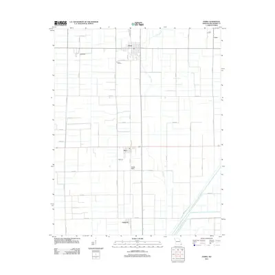
2012 Map of Parma
USGS Topo · Published 2012About this map
The town of Parma anchors this 2012 survey, situated in a landscape defined by the agricultural geometry of New Madrid County. This region of southeast Missouri displays a meticulously engineered drainage network, illustrated by the prominent Ditch Number 1 and the winding course of Caney Slough. These water management features allowed the conversion of swampy bottomlands into a productive grid of farm roads and fields. Smaller rail-oriented settlements and loading points like Risco, Tallapoosa, and Forest Spur are visible along the corridors, while Parma Cemetery and Como Cemetery provide essential touchpoints for genealogical research. The map also captures several unincorporated communities, including Lorwood and Como, connected by a web of county routes such as Co HWY 540 and Co HWY 521.
Find a feature on this map
42 named features on this map. Tap any name to fly to it.
Don’t see what you’re looking for? This feature index may not catch every label — zoom into the map to look around manually.
Map Details
Editions of this 2012 Parma Map
This is the sole edition of this map. No revisions or reprints were ever made.
Other maps of this area

1939 · Portageville
USGS Topo · 1:62,500

1939 · New Madrid
USGS Topo · 1:62,500

1940 · Malden
USGS Topo · 1:62,500

1940 · Pascola
USGS Topo · 1:62,500

1954 · New Madrid
USGS Topo · 1:62,500

1955 · Pascola
USGS Topo · 1:62,500

1955 · Portageville
USGS Topo · 1:62,500

1956 · Malden
USGS Topo · 1:62,500

1956 · Dyersburg
USGS Topo · 1:250,000
1971 · Catron
USGS Topo · 1:24,000