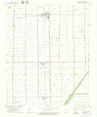
1978 Map of Parma
USGS Topo · Published 1979About this map
Parma and Risco anchor this survey of the Missouri Bootheel, revealing a landscape defined by an extensive drainage and water management system. The grid-like patterns of agricultural fields are interspersed with an intricate network of numbered channels, including Ditch No 1, Ditch No 44, and Ditch No 290, which serve to reclaim the low-lying terrain. To the southeast, the massive scale of The Floodway demonstrates the significant engineering efforts required to manage the regional hydrology.
Find a feature on this map
26 named features on this map. Tap any name to fly to it.
Don’t see what you’re looking for? This feature index may not catch every label — zoom into the map to look around manually.
Map Details
Editions of this 1978 Parma Map
This is the sole edition of this map. No revisions or reprints were ever made.
Other maps of this area

1939 · Portageville
USGS Topo · 1:62,500

1939 · New Madrid
USGS Topo · 1:62,500

1940 · Malden
USGS Topo · 1:62,500

1940 · Pascola
USGS Topo · 1:62,500

1954 · New Madrid
USGS Topo · 1:62,500

1955 · Pascola
USGS Topo · 1:62,500

1955 · Portageville
USGS Topo · 1:62,500

1956 · Malden
USGS Topo · 1:62,500

1956 · Dyersburg
USGS Topo · 1:250,000
1971 · Catron
USGS Topo · 1:24,000