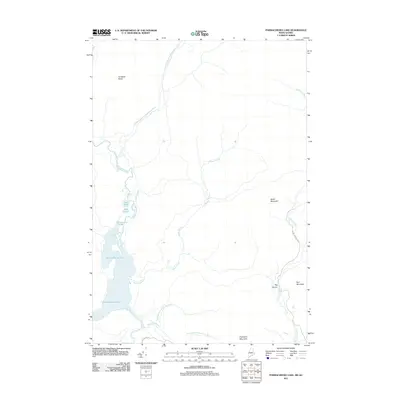
2011 Map of Parmachenee Lake
USGS Topo · Published 2011About this map
Parmachenee Lake and its surrounding watershed define this remote borderland landscape where the northern Maine woods meet the Quebec line. The area is dominated by an intricate network of moving water, including the southward flow of the Magalloway River and its various tributaries such as the First East Branch Magalloway River and the North Branch Black Cat Brook. To the east, the Cupsuptic River carves through the terrain, passing near the dramatic Big Canyon and beneath the slopes of Cupsuptic Mountain. A series of smaller basins, including Otter Pond, Wells Pond, and Cleveland Pond, are clustered north of the main lake. The map reflects a landscape of timber and topography, where land use is signaled by routes like Burnt Mountain Rd and Green Top Rd, which weave through the high ground of Thrasher Peaks and Bottle Mountain.
Find a feature on this map
21 named features on this map. Tap any name to fly to it.
Don’t see what you’re looking for? This feature index may not catch every label — zoom into the map to look around manually.
Map Details
Editions of this 2011 Parmachenee Lake Map
This is the sole edition of this map. No revisions or reprints were ever made.
Other maps of this area

1927 · Moose Bog
USGS Topo · 1:48,000

1927 · Second Lake
USGS Topo · 1:62,500

1931 · Cupsuptic
USGS Topo · 1:48,000

1931 · Moose Bog
USGS Topo · 1:62,500

1932 · Second Lake
USGS Topo · 1:62,500

1932 · Arnold Pond
USGS Topo · 1:48,000

1934 · Cupsuptic
USGS Topo · 1:62,500

1935 · Cupsuptic
USGS Topo · 1:62,500

1935 · Arnold Pond
USGS Topo · 1:62,500

1949 · Jackman
USGS Topo · 1:250,000