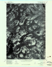
1977 Map of Parmachenee Lake
USGS Topo · Published 1983About this map
Magalloway River and the neighboring drainage of the Cupsuptic River define this stretch of the Maine-Quebec borderlands during the late 1970s. This orthophotograph, derived from high-altitude aerial imagery, reveals the complex texture of the North Woods, where logging roads and clearings contrast with the dense timber of Bottle Mountain. The map provides a raw visual record of the land surface, showing the winding course of Moose Brook as it feeds into the western waterways. Unlike traditional topographic maps that use contour lines, this format uses rectified imagery to show the actual forest canopy and river banks exactly as they existed on October 31, 1977, offering researchers a literal view of the timber management and riparian environment of the era.
Find a feature on this map
4 named features on this map. Tap any name to fly to it.
Don’t see what you’re looking for? This feature index may not catch every label — zoom into the map to look around manually.
Map Details
Editions of this 1977 Parmachenee Lake Map
This is the sole edition of this map. No revisions or reprints were ever made.
Other maps of this area

1927 · Moose Bog
USGS Topo · 1:48,000

1927 · Second Lake
USGS Topo · 1:62,500

1931 · Cupsuptic
USGS Topo · 1:48,000

1931 · Moose Bog
USGS Topo · 1:62,500

1932 · Second Lake
USGS Topo · 1:62,500

1932 · Arnold Pond
USGS Topo · 1:48,000

1934 · Cupsuptic
USGS Topo · 1:62,500

1935 · Cupsuptic
USGS Topo · 1:62,500

1935 · Arnold Pond
USGS Topo · 1:62,500

1949 · Jackman
USGS Topo · 1:250,000