
1953 Map of Parnell
USGS Topo · Published 1955About this map
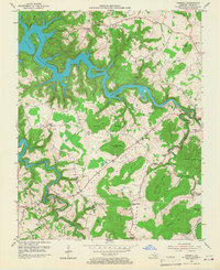
Lake Cumberland dominates the northwestern reaches of this mid-century Wayne County landscape, its rising waters shaping the shoreline around Big Island and Ramsey Island. The topography reflects a transition from the winding valleys of Beaver Creek and Otter Creek to the high elevations of Magalton Mtn and Pilot Mtn. This era shows a distributed rural society defined by small crossroads like Parnell, Zula, and Slat, each tied together by a dense network of country schools and churches.
Find a feature on this map
61 named features on this map. Tap any name to fly to it.
Don’t see what you’re looking for? This feature index may not catch every label — zoom into the map to look around manually.
Map Details
Editions of this 1953 Parnell Map
2 editions found
Other maps of this area

1911 · Monticello
USGS Topo · 1:62,500

1914 · Monticello
USGS Topo · 1:62,500

1929 · Byrdstown
USGS Topo · 1:62,500

1934 · Pall Mall
USGS Topo · 1:62,500

1953 · Monticello
USGS Topo · 1:24,000

1953 · Mill Springs
USGS Topo · 1:24,000

1953 · Jamestown
USGS Topo · 1:24,000

1954 · Jabez
USGS Topo · 1:24,000

1954 · Parmleysville
USGS Topo · 1:24,000

1954 · Cumberland City
USGS Topo · 1:24,000