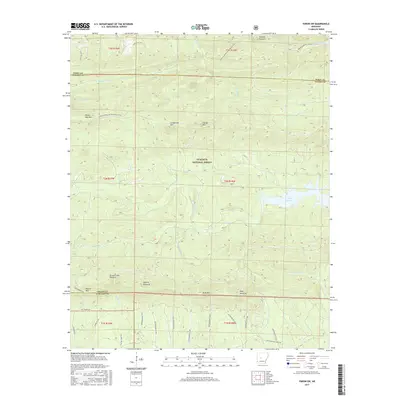
2017 Map of Paron SW
USGS Topo · Published 2017About this map
Lake Winona and the Alum Fork Saline River dominate this interior section of the Ouachita National Forest, where the landscape is defined by its dramatic topography. The terrain is marked by a series of prominent peaks and pinnacles, including Flatside Pinnacle, Bread Creek Pinnacle, and Angling Pinnacle, which served as distinct natural landmarks for early explorers and surveyors. The drainage patterns of Little Cedar Creek and the North Fork Saline River showcase the intricate watershed of the Saline and Perry County borderlands. This region, largely undeveloped and managed for conservation, features an extensive network of forestry roads and the Ouachita National Recreation Trail. The map documents a rugged timber and watershed management area, highlighting named heights like Grindstone Mountain and White Oak Mountain that remain essential features of the Arkansas highlands.
Find a feature on this map
49 named features on this map. Tap any name to fly to it.
Don’t see what you’re looking for? This feature index may not catch every label — zoom into the map to look around manually.
Map Details
Editions of this 2017 Paron SW Map
This is the sole edition of this map. No revisions or reprints were ever made.
Other maps of this area

1890 · Benton
USGS Topo · 1:125,000

1890 · Hot Springs
USGS Topo · 1:125,000

1894 · Hot Springs
USGS Topo · 1:125,000

1894 · Benton
USGS Topo · 1:125,000

1955 · Little Rock
USGS Topo · 1:250,000

1956 · Little Rock
USGS Topo · 1:250,000

1960 · Little Rock
USGS Topo · 1:250,000

1963 · Paron SW
USGS Topo · 1:24,000
1963 · Thornburg
USGS Topo · 1:24,000
1963 · Aplin
USGS Topo · 1:24,000