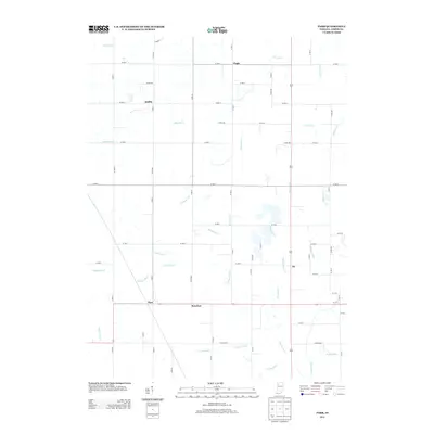
2013 Map of Parr
USGS Topo · Published 2013About this map
The Iroquois River winds through this Jasper County landscape, defining a region where intricate water management has shaped the land for agriculture. Small rural clusters and former rail-stop settlements like Parr, Rosebud, and Aix anchor the southern half of the map, while Virgie and Moffitt lie further north. The terrain is characterized by an extensive network of named waterways including Jungles Ditch, Bruner Ditch, and Rockwell Ditch. This system of drainage reflects the historical conversion of wetlands into productive farmland, a central theme in the development of Northwest Indiana. The rigid grid of county roads, such as Co RD-650 and Co RD-900, provides a window into the parceling and accessibility of these agricultural stretches during the early twenty-first century.
Find a feature on this map
62 named features on this map. Tap any name to fly to it.
Don’t see what you’re looking for? This feature index may not catch every label — zoom into the map to look around manually.
Map Details
Editions of this 2013 Parr Map
This is the sole edition of this map. No revisions or reprints were ever made.
Other maps of this area

1953 · Chicago
USGS Topo · 1:250,000

1953 · Danville
USGS Topo · 1:250,000

1955 · Danville
USGS Topo · 1:250,000

1956 · Danville
USGS Topo · 1:250,000

1957 · Chicago
USGS Topo · 1:250,000

1957 · Wheatfield
USGS Topo · 1:24,000

1957 · DeMotte
USGS Topo · 1:24,000

1959 · Shelby
USGS Topo · 1:24,000

1961 · Mount Ayr
USGS Topo · 1:24,000

1962 · Gifford
USGS Topo · 1:24,000