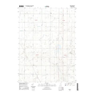
2016 Map of Parr
USGS Topo · Published 2016About this map
Agricultural lands and a sophisticated network of drainage infrastructure define the landscape of northern Jasper County on this 2016 survey. Small, historic settlements like Parr and Aix are situated along a grid of section roads, anchored by local burial grounds including Yeoman Cem and Dunkard Cem. The region's geography is heavily modified by an extensive system of waterways such as Stover Ditch, Davis Ditch, and Davison Ditch, which channel water toward the south where the Iroquois River meanders across the territory. These ditches, often following section lines, represent the critical engineering required to maintain the productivity of this prairie region. Near Virgie in the north and the cluster of Sandridge Cem and Price Cem in the east, the map details the persistent intersection of pioneer-era landmarks with modern rural land management.
Find a feature on this map
44 named features on this map. Tap any name to fly to it.
Don’t see what you’re looking for? This feature index may not catch every label — zoom into the map to look around manually.
Map Details
Editions of this 2016 Parr Map
This is the sole edition of this map. No revisions or reprints were ever made.
Other maps of this area

1953 · Chicago
USGS Topo · 1:250,000

1953 · Danville
USGS Topo · 1:250,000

1955 · Danville
USGS Topo · 1:250,000

1956 · Danville
USGS Topo · 1:250,000

1957 · Chicago
USGS Topo · 1:250,000

1957 · Wheatfield
USGS Topo · 1:24,000

1957 · DeMotte
USGS Topo · 1:24,000

1959 · Shelby
USGS Topo · 1:24,000

1961 · Mount Ayr
USGS Topo · 1:24,000

1962 · Gifford
USGS Topo · 1:24,000