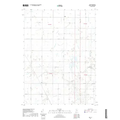
2019 Map of Parr
USGS Topo · Published 2019About this map
Parr and Aix sit within a highly organized agricultural landscape in southern Jasper County, where the natural drainage of the Iroquois River has been extensively augmented by a network of man-made waterways. This 2019 survey reveals how the local economy is structured around these drainage systems, including Jungles Ditch, Rowan Ditch, and Brunner Ditch, which follow the township and section lines of the Public Land Survey System. These ditches are essential for managing the low-lying prairie land, allowing for the dense grid of county roads that connect the small settlements of the region.
Find a feature on this map
57 named features on this map. Tap any name to fly to it.
Don’t see what you’re looking for? This feature index may not catch every label — zoom into the map to look around manually.
Map Details
Editions of this 2019 Parr Map
This is the sole edition of this map. No revisions or reprints were ever made.
Other maps of this area

1953 · Chicago
USGS Topo · 1:250,000

1953 · Danville
USGS Topo · 1:250,000

1955 · Danville
USGS Topo · 1:250,000

1956 · Danville
USGS Topo · 1:250,000

1957 · Chicago
USGS Topo · 1:250,000

1957 · Wheatfield
USGS Topo · 1:24,000

1957 · DeMotte
USGS Topo · 1:24,000

1959 · Shelby
USGS Topo · 1:24,000

1961 · Mount Ayr
USGS Topo · 1:24,000

1962 · Gifford
USGS Topo · 1:24,000