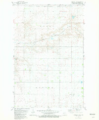
1981 Map of Parshall NE
USGS Topo · Published 1981About this map
The Fort Berthold Indian Reservation boundary cuts across the northern portion of this landscape, marking a significant jurisdictional division in Mountrail County during the early 1980s. The northern section is dominated by the winding path of East Fork Shell Creek, which meanders through a series of draws and depressions. Human activity is largely defined by the agricultural and industrial grid, including the Soo Line railroad crossing the terrain. Scattered Gravel Pits indicate local resource extraction, while the presence of a Townhall in the southeastern quadrant suggests a central point for the surrounding rural communities of Banner and Model. The survey provides a clear look at the township and range system, documenting fence lines and field limits that defined the agrarian footprint of the Missouri Plateau before modern shifts in land use.
Find a feature on this map
9 named features on this map. Tap any name to fly to it.
Don’t see what you’re looking for? This feature index may not catch every label — zoom into the map to look around manually.
Map Details
Editions of this 1981 Parshall NE Map
This is the sole edition of this map. No revisions or reprints were ever made.
Other maps of this area

1953 · Williston
USGS Topo · 1:250,000

1953 · Watford City
USGS Topo · 1:250,000

1954 · Minot
USGS Topo · 1:250,000

1954 · McClusky
USGS Topo · 1:250,000

1956 · Makoti SW
USGS Topo · 1:24,000

1957 · Williston
USGS Topo · 1:250,000

1957 · Watford City
USGS Topo · 1:250,000

1958 · McClusky
USGS Topo · 1:250,000

1958 · Minot
USGS Topo · 1:250,000

1967 · Watford City
USGS Topo · 1:250,000