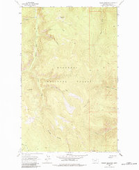
1963 Map of Parsnip Mountain
USGS Topo · Published 1984About this map
Kootenai National Forest lands dominate this mountainous reach of Lincoln County, defined by the high prominence of Parsnip Mountain. The landscape in the early 1960s is characterized by a network of drainage systems, including the headwaters of Copeland Creek and South Fork Big Creek. A singular Lookout Tower sits atop Pinto Point, a critical vantage for fire management within the heavy timber of this region.
Find a feature on this map
19 named features on this map. Tap any name to fly to it.
Don’t see what you’re looking for? This feature index may not catch every label — zoom into the map to look around manually.
Map Details
Editions of this 1963 Parsnip Mountain Map
2 editions found
Other maps of this area

1957 · Kalispell
USGS Topo · 1:250,000

1960 · Kalispell
USGS Topo · 1:250,000

1961 · Kalispell
USGS Topo · 1:250,000

1963 · Pink Mountain
USGS Topo · 1:24,000

1963 · Banfield Mountain
USGS Topo · 1:24,000

1963 · Webb Mountain
USGS Topo · 1:24,000

1963 · Boulder Lakes
USGS Topo · 1:24,000
1963 · Inch Mountain
USGS Topo · 1:24,000

1963 · Lost Horse Mountain
USGS Topo · 1:24,000
1963 · Gold Hill
USGS Topo · 1:24,000