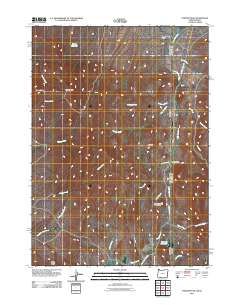
2011 Map of Parsnip Peak
USGS Topo · Published 2011About this map
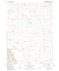
Sagebrush Mountain and Parsnip Peak dominate this high-desert landscape in Malheur County, where the high-elevation terrain is defined by a complex network of seasonal drainages and isolated water improvements. This 2011 survey illustrates the ranching infrastructure of the region, anchored by the Lone Tree Ranch and essential water sources like Wroten Reservoir and Salt Lick Reservoir. The rugged topography is etched with numerous named gulches and creeks, including Whiskey Creek, Chicken Creek, and Toppin Creek, which flow toward the Idaho border. The area's transit is limited to rural ranch corridors such as Soldier Creek Rd and Chas Maher Ranch Rd, reflecting the remote, agrarian character of this corner of the Pacific Northwest. This map provides a detailed view of the natural landmarks and grazing lands that have supported local livelihoods for generations.
Find a feature on this map
28 named features on this map. Tap any name to fly to it.
Don’t see what you’re looking for? This feature index may not catch every label — zoom into the map to look around manually.
Map Details
Editions of this 2011 Parsnip Peak Map
This is the sole edition of this map. No revisions or reprints were ever made.
Other maps of this area

1955 · Jordan Valley
USGS Topo · 1:250,000

1957 · Jordan Valley
USGS Topo · 1:250,000

1958 · Jordan Valley
USGS Topo · 1:250,000

1965 · Flint Creek
USGS Topo · 1:62,500
1969 · Juniper Ridge
USGS Topo · 1:24,000
1969 · Antelope Reservoir
USGS Topo · 1:24,000
1969 · Jordan Valley
USGS Topo · 1:24,000

1973 · Cliffs
USGS Topo · 1:24,000

1980 · Juniper Point
USGS Topo · 1:24,000
1980 · Whitehorse Butte
USGS Topo · 1:24,000