
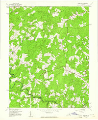
1942 Map of Partlow
USGS Topo · Published 1942About this map
North Anna River defines the southern boundary of this rural Piedmont landscape, where the confluence of several counties meets amidst a network of small family-named crossroads and rural outposts. The Corps of Engineers survey details a pre-war community structure centered around general stores and historic congregational sites, such as Duerson Store and the nearby Wallers Church. Moving through the undulating terrain, the map traces the critical transit points over local waterways, including Smiths Mill Bridge and Davenport Bridge, which connected the disparate settlements of Lewiston and Partlow. This 1942 depiction reveals an agricultural region still heavily reliant on its river crossings and neighborhood centers like Chewnings Corner and Harris Store, providing a clear view of the road network before the expansion of modern highways altered the local geography.
Find a feature on this map
23 named features on this map. Tap any name to fly to it.
Don’t see what you’re looking for? This feature index may not catch every label — zoom into the map to look around manually.
Map Details
Editions of this 1942 Partlow Map
2 editions found
Other maps of this area

1887 · Spottsylvania
USGS Topo · 1:125,000

1890 · Goochland
USGS Topo · 1:125,000

1892 · Spottsylvania
USGS Topo · 1:125,000

1892 · Goochland
USGS Topo · 1:125,000

1942 · Ladysmith
USGS Topo · 1:31,680

1942 · Belmont
USGS Topo · 1:31,680

1942 · Contrary Creek
USGS Topo · 1:31,680

1942 · Spotsylania
USGS Topo · 1:31,680

1942 · Brokenburg
USGS Topo · 1:31,680

1942 · Buckner
USGS Topo · 1:24,000