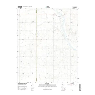
2016 Map of Parvin
USGS Topo · Published 2016About this map
Parvin sits atop the undulating terrain of northwestern Oklahoma, situated along the county line where Blaine Co meets Kingfisher Co. The landscape is defined by the winding course of the Cimarron River as it cuts across the northeastern corner, fed by several drainages including Salt Creek, Pepper Cr, and Spring Cr. This area is particularly significant for genealogical research, as it preserves the locations of several distinct community burial grounds. Scattered across the section lines are Parvin Cem, Holcomb-Cook Cem, Todd Cem, East Cooper Cem, and Immanuel Cem, each representing the early families who settled this agricultural region. The road network, including W Jack Choate Ave and numerous numbered section roads, follows a rigid grid that contrasts with the fluid, meandering paths of the river and its tributaries.
Find a feature on this map
30 named features on this map. Tap any name to fly to it.
Don’t see what you’re looking for? This feature index may not catch every label — zoom into the map to look around manually.
Map Details
Editions of this 2016 Parvin Map
This is the sole edition of this map. No revisions or reprints were ever made.
Other maps of this area

1893 · Loyal
USGS Topo · 1:62,500

1893 · Ames
USGS Topo · 1:62,500

1955 · Clinton
USGS Topo · 1:250,000

1955 · Woodward
USGS Topo · 1:250,000

1956 · Ames
USGS Topo · 1:62,500

1957 · Clinton
USGS Topo · 1:250,000

1958 · Woodward
USGS Topo · 1:250,000
1972 · Loyal NW
USGS Topo · 1:24,000
1972 · Loyal
USGS Topo · 1:24,000

1972 · Okeene
USGS Topo · 1:24,000