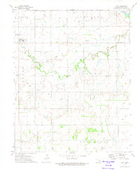
1972 Map of Loyal
USGS Topo · Published 1974About this map
The Loyal townsite serves as the primary hub of this 1970s landscape, situated in western Kingfisher County. This era is defined by a dense network of energy infrastructure, where a sprawling Gas Field and numerous Oil Well sites are connected by an extensive system of Pipeline routes. The terrain is deeply etched by the winding course of Cooper Creek, which flows eastward toward the Cimarron River in the northeastern corner of the map.
Find a feature on this map
22 named features on this map. Tap any name to fly to it.
Don’t see what you’re looking for? This feature index may not catch every label — zoom into the map to look around manually.
Map Details
Editions of this 1972 Loyal Map
This is the sole edition of this map. No revisions or reprints were ever made.
Other maps of this area

1892 · Kingfisher
USGS Topo · 1:125,000

1893 · Hennessey
USGS Topo · 1:62,500

1893 · Loyal
USGS Topo · 1:62,500

1893 · Ames
USGS Topo · 1:62,500

1895 · Kingfisher
USGS Topo · 1:125,000

1954 · Oklahoma City
USGS Topo · 1:250,000

1955 · Clinton
USGS Topo · 1:250,000

1955 · Enid
USGS Topo · 1:250,000

1955 · Woodward
USGS Topo · 1:250,000

1956 · Ames
USGS Topo · 1:62,500