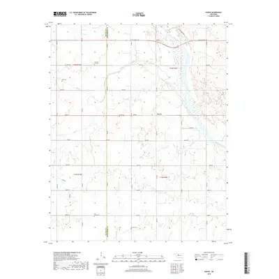
2018 Map of Parvin
USGS Topo · Published 2018About this map
Parvin sits at the center of this 2018 survey, marking a quiet agricultural landscape along the northern bank of the Cimarron River. The terrain is defined by the winding paths of Salt Creek and Pepper Cr, which drain into the river's broad, sandy bed. This map is particularly valuable for genealogists, as it meticulously records several family and community burial grounds across the rural sections of Kingfisher and Blaine counties.
Find a feature on this map
34 named features on this map. Tap any name to fly to it.
Don’t see what you’re looking for? This feature index may not catch every label — zoom into the map to look around manually.
Map Details
Editions of this 2018 Parvin Map
This is the sole edition of this map. No revisions or reprints were ever made.
Other maps of this area

1893 · Loyal
USGS Topo · 1:62,500

1893 · Ames
USGS Topo · 1:62,500

1955 · Clinton
USGS Topo · 1:250,000

1955 · Woodward
USGS Topo · 1:250,000

1956 · Ames
USGS Topo · 1:62,500

1957 · Clinton
USGS Topo · 1:250,000

1958 · Woodward
USGS Topo · 1:250,000
1972 · Loyal NW
USGS Topo · 1:24,000
1972 · Loyal
USGS Topo · 1:24,000

1972 · Okeene
USGS Topo · 1:24,000