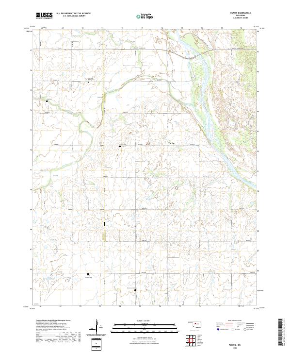
2022 Map of Parvin
USGS Topo · Published 2022About this map
The Cimarron River winds through the eastern portion of this landscape, defining the local geography where Kingfisher and Blaine counties meet. The small settlement of Parvin serves as a central point in an area dominated by agricultural section lines and seasonal waterways. Historically-minded researchers will find a high concentration of small burial grounds scattered across the terrain, including the Holcomb - Cook Cem near the northern boundary and the East Cooper Cem further south. These family-named landmarks, along with the Todd Cem and Immanuel Cem, suggest a pattern of early homesteading and localized community development. The drainage network, featuring Salt Creek and Spring Cr, dictates the movement of roads like W Jack Choate Ave, illustrating how the Oklahoma plains were sectioned around its vital water sources.
Find a feature on this map
34 named features on this map. Tap any name to fly to it.
Don’t see what you’re looking for? This feature index may not catch every label — zoom into the map to look around manually.
Map Details
Editions of this 2022 Parvin Map
This is the sole edition of this map. No revisions or reprints were ever made.
Other maps of this area

1893 · Loyal
USGS Topo · 1:62,500

1893 · Ames
USGS Topo · 1:62,500

1955 · Clinton
USGS Topo · 1:250,000

1955 · Woodward
USGS Topo · 1:250,000

1956 · Ames
USGS Topo · 1:62,500

1957 · Clinton
USGS Topo · 1:250,000

1958 · Woodward
USGS Topo · 1:250,000
1972 · Loyal NW
USGS Topo · 1:24,000
1972 · Loyal
USGS Topo · 1:24,000

1972 · Okeene
USGS Topo · 1:24,000