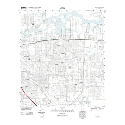
2010 Map of Pasadena
USGS Topo · Published 2010About this map
Buffalo Bayou and its industrial corridor dominate the northern landscape of this 2010 study, illustrating the dense residential and commercial expansion east of Houston. This period reveals a complex network of neighborhoods such as Golden Acres, Parkview Manor, and Pasadena Gardens, which sit alongside established waterways like Vince Bayou and Hunting Bayou. The presence of the Pasadena Post Office, South Houston Post Office, and Galena Park Post Office underscores the administrative and civic structure of these interconnected communities. The map provides an intricate look at the suburban footprint before later 21st-century redevelopment, showing the transition from the maritime industrial edges of Boggy Basin to the residential streets of Meadow Creek Village and Freeway Manor. This detailed layout is essential for understanding the infrastructure and settlement patterns of southeastern Harris County during the early 2010s.
Find a feature on this map
65 named features on this map. Tap any name to fly to it.
Don’t see what you’re looking for? This feature index may not catch every label — zoom into the map to look around manually.
Map Details
Editions of this 2010 Pasadena Map
This is the sole edition of this map. No revisions or reprints were ever made.
Other maps of this area

1915 · Park Place
USGS Topo · 1:24,000

1915 · Deepwater
USGS Topo · 1:24,000

1916 · Genoa
USGS Topo · 1:24,000

1916 · Burnett Bay
USGS Topo · 1:24,000

1916 · Settegast
USGS Topo · 1:24,000

1916 · Seabrook
USGS Topo · 1:24,000

1916 · Fauna
USGS Topo · 1:24,000

1916 · La Porte
USGS Topo · 1:24,000

1919 · Deepwater
USGS Topo · 1:31,680

1920 · Seabrook
USGS Topo · 1:31,680