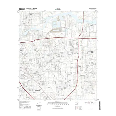
2016 Map of Pasadena
USGS Topo · Published 2016About this map
Pasadena and its neighboring industrial and residential corridors are defined by the winding course of the Houston Ship Channel and Buffalo Bayou. This modern survey illustrates the dense urban expansion south of Galena Park, where the local economy and geography are inseparable from the heavy shipping and maritime infrastructure. The landscape is a network of bayous, including Vince Bayou, Sims Bayou, and Berry Bayou, which thread between established neighborhoods and large-scale industrial zones. Notable educational institutions like the Texas Chiropractic Coll Foundation Inc and the San Jacinto Community Coll District are prominent landmarks in the residential blocks of Pasadena. To the south, the settlement of Genoa sits near the Sam Houston Pkwy, marking the transition toward more open suburban planning compared to the tightly gridded streets of South Houston and Allendale.
Find a feature on this map
55 named features on this map. Tap any name to fly to it.
Don’t see what you’re looking for? This feature index may not catch every label — zoom into the map to look around manually.
Map Details
Editions of this 2016 Pasadena Map
This is the sole edition of this map. No revisions or reprints were ever made.
Other maps of this area

1915 · Park Place
USGS Topo · 1:24,000

1915 · Deepwater
USGS Topo · 1:24,000

1916 · Genoa
USGS Topo · 1:24,000

1916 · Burnett Bay
USGS Topo · 1:24,000

1916 · Settegast
USGS Topo · 1:24,000

1916 · Seabrook
USGS Topo · 1:24,000

1916 · Fauna
USGS Topo · 1:24,000

1916 · La Porte
USGS Topo · 1:24,000

1919 · Deepwater
USGS Topo · 1:31,680

1920 · Seabrook
USGS Topo · 1:31,680