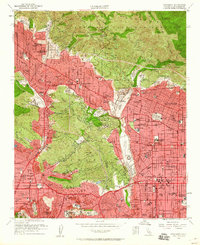
1953 Map of Pasadena
USGS Topo · Published 1960About this map
The San Rafael Hills and Verdugo Mts provide a rugged green frame for the rapid postwar suburban expansion of the Los Angeles basin. In the early 1950s, the foothills of the San Gabriel Mountains show a dense network of residential growth connecting La Cañada, Flintridge, and Altadena. This era marks the prominence of major technical and educational institutions, most notably the Jet Propulsion Laboratory situated near the Arroyo Seco, alongside the Calif Institute of Technology and Occidental College.
Find a feature on this map
126 named features on this map. Tap any name to fly to it.
Don’t see what you’re looking for? This feature index may not catch every label — zoom into the map to look around manually.
Map Details
Editions of this 1953 Pasadena Map
3 editions found
Other maps of this area

1894 · Los Angeles
USGS Topo · 1:62,500

1896 · Pasadena
USGS Topo · 1:62,500

1896 · Santa Monica
USGS Topo · 1:62,500

1898 · Santa Monica
USGS Topo · 1:62,500

1900 · Pasadena
USGS Topo · 1:62,500

1900 · Tujunga
USGS Topo · 1:62,500

1900 · Los Angeles
USGS Topo · 1:62,500

1900 · Fernando
USGS Topo · 1:62,500

1901 · Southern California Sheet No. 1
USGS Topo · 1:250,000

1902 · Santa Monica
USGS Topo · 1:62,500