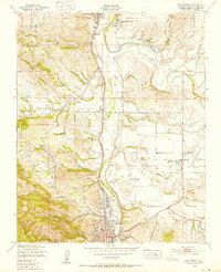
1948 Map of Paso Robles
USGS Topo · Published 1952About this map
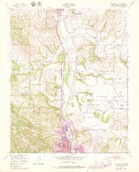
San Miguel and Paso Robles anchor this late 1940s landscape, positioned along the vital corridor of the Southern Pacific railroad and the Salinas River. The map highlights a rural California transition, where the Camp Roberts Military Reservation occupies the northwest and the State School For Boys sits toward the east. Cultural landmarks like the San Miguel Mission and the Old Adobe provide a deep sense of place among the winding drainages of Huerhuero Creek and San Jacinto Creek. Numerous windmills are scattered across the terrain, illustrating the importance of groundwater for small settlements like Wellsona and Oak Park. The grid of Paso Robles shows early urban development, including the Fair Grounds and City Hall, just south of where the Estrella River meets the Salinas.
Find a feature on this map
39 named features on this map. Tap any name to fly to it.
Don’t see what you’re looking for? This feature index may not catch every label — zoom into the map to look around manually.
Map Details
Editions of this 1948 Paso Robles Map
7 editions found
Other maps of this area

1919 · San Miguel
USGS Topo · 1:62,500

1919 · Paso Robles
USGS Topo · 1:62,500

1919 · Bradley
USGS Topo · 1:62,500

1919 · Adelaida
USGS Topo · 1:62,500

1932 · Adelaida
USGS Topo · 1:62,500

1941 · Bradley
USGS Topo · 1:62,500

1942 · Adelaida
USGS Topo · 1:62,500

1943 · Paso Robles
USGS Topo · 1:62,500

1947 · San Luis Obispo
USGS Topo · 1:250,000

1947 · San Miguel
USGS Topo · 1:62,500