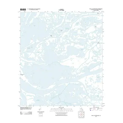
2012 Map of Pass a Loutre West
USGS Topo · Published 2012About this map
The Mississippi River Delta reveals its intricate, fluid geography in this modern survey of Plaquemines Parish. This water-dominant landscape is defined by a complex network of passes and islands where the river meets the Gulf, characterized by features like Goose Island and Spanish Island. The area shows the imprint of industrial activity through the Raphael Pass Gas Field, while dozens of locally named water bodies—such as Dead Women Inside Pond, Camps Pond, and Bastian Lake—suggest a rich history of local nomenclature tied to navigation and subsistence. The mapping of the Parry O'Neill Reef and various bends like Hingle Bend underscores the dynamic and hazardous nature of these coastal waterways as they existed in the early twenty-first century.
Find a feature on this map
52 named features on this map. Tap any name to fly to it.
Don’t see what you’re looking for? This feature index may not catch every label — zoom into the map to look around manually.
Map Details
Editions of this 2012 Pass a Loutre West Map
This is the sole edition of this map. No revisions or reprints were ever made.
Other maps of this area

1893 · East Delta
USGS Topo · 1:62,500

1893 · Forts
USGS Topo · 1:62,500

1893 · West Delta
USGS Topo · 1:62,500

1935 · Garden Island Pass
USGS Topo · 1:31,680

1935 · South Pass
USGS Topo · 1:31,680

1947 · Garden Island Pass
USGS Topo · 1:31,680

1947 · Pass A Loutre West
USGS Topo · 1:31,680

1947 · Venice
USGS Topo · 1:31,680

1947 · Southwest Pass
USGS Topo · 1:31,680

1947 · Main Pass
USGS Topo · 1:31,680