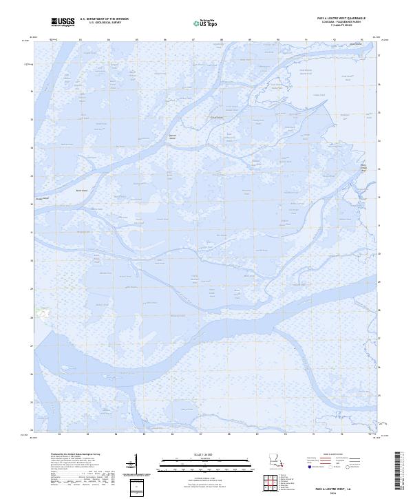
2024 Map of Pass a Loutre West
USGS Topo · Published 2024About this map
The Delta National Wildlife Refuge dominates this coastal Louisiana landscape, where the Mississippi River delta disintegrates into a complex network of marshes, passes, and shallow ponds. This environment is characterized by family-named waterways and features like John Johnson Pond and Joe Dennis Pond, which suggest a history of local maritime use and individual land claims in a remote wetlands setting.
Find a feature on this map
114 named features on this map. Tap any name to fly to it.
Don’t see what you’re looking for? This feature index may not catch every label — zoom into the map to look around manually.
Map Details
Editions of this 2024 Pass a Loutre West Map
This is the sole edition of this map. No revisions or reprints were ever made.
Other maps of this area

1893 · East Delta
USGS Topo · 1:62,500

1893 · Forts
USGS Topo · 1:62,500

1893 · West Delta
USGS Topo · 1:62,500

1935 · Garden Island Pass
USGS Topo · 1:31,680

1935 · South Pass
USGS Topo · 1:31,680

1947 · Garden Island Pass
USGS Topo · 1:31,680

1947 · Pass A Loutre West
USGS Topo · 1:31,680

1947 · Venice
USGS Topo · 1:31,680

1947 · Southwest Pass
USGS Topo · 1:31,680

1947 · Main Pass
USGS Topo · 1:31,680