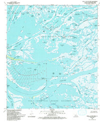
1993 Map of Pass A Loutre West
USGS Topo · Published 1993About this map
Delta Duck Oil Field and scattered petroleum platforms define the industrial footprint across this aquatic landscape at the Mississippi River Delta's edge. The map reveals a complex hydrologic network where major waterways like Brant Bayou and Hingle Pass weave between countless named water bodies, including Sabol Pond and Joe Dennis Pond. This territory, largely managed as the Delta National Wildlife Refuge and the State Wildlife Management Area, shows the delicate balance between natural conservation and resource extraction in the late twentieth century. Significant landmarks for navigation and industry, such as the Head of Passes, various lights, and numerous sludge pits, reflect the ongoing human presence in this ever-shifting terrain of islands like Goose Island and Spanish Island.
Find a feature on this map
99 named features on this map. Tap any name to fly to it.
Don’t see what you’re looking for? This feature index may not catch every label — zoom into the map to look around manually.
Map Details
Editions of this 1993 Pass A Loutre West Map
This is the sole edition of this map. No revisions or reprints were ever made.
Other maps of this area

1893 · East Delta
USGS Topo · 1:62,500

1893 · Forts
USGS Topo · 1:62,500

1893 · West Delta
USGS Topo · 1:62,500

1935 · Garden Island Pass
USGS Topo · 1:31,680

1935 · South Pass
USGS Topo · 1:31,680

1947 · Garden Island Pass
USGS Topo · 1:31,680

1947 · Pass A Loutre West
USGS Topo · 1:31,680

1947 · Venice
USGS Topo · 1:31,680

1947 · Southwest Pass
USGS Topo · 1:31,680

1947 · Main Pass
USGS Topo · 1:31,680