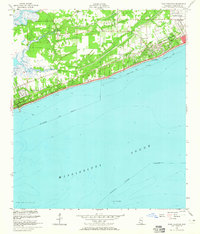
1955 Map of Pass Christian
USGS Topo · Published 1965About this map
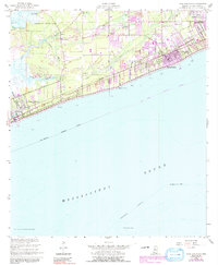
The Mississippi Sound shoreline of Harrison County defines this mid-century survey, capturing a era of established coastal development before modern hurricanes reshaped the Gulf Coast. The landscape is heavily marked by long-standing private land grants, including the Alexander Dimitry Claim and the Widow N Ladner Claim, which contrast with the regular township and range grid. Along the waterfront, the twin communities of Pass Christian and Long Beach are oriented toward the sea, while the Louisville and Nashville railroad runs parallel to the coast, serving as a primary corridor for transportation and growth.
Find a feature on this map
32 named features on this map. Tap any name to fly to it.
Don’t see what you’re looking for? This feature index may not catch every label — zoom into the map to look around manually.
Map Details
Editions of this 1955 Pass Christian Map
6 editions found
Other maps of this area

1893 · Cat Island
USGS Topo · 1:62,500

1893 · Toulme
USGS Topo · 1:62,500

1946 · Isle Au Pitre
USGS Topo · 1:31,680

1951 · Cat Island
USGS Topo · 1:24,000

1953 · Mobile
USGS Topo · 1:250,000

1954 · Isle Au Pitre
USGS Topo · 1:31,680

1954 · Gulfport North
USGS Topo · 1:24,000

1954 · Gulfport South
USGS Topo · 1:24,000

1955 · Pass Christian
USGS Topo · 1:24,000
1955 · Isle Au Pitre
USGS Topo · 1:24,000