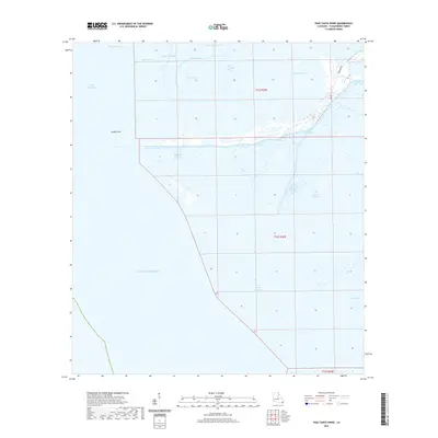
2020 Map of Pass Tante Phine
USGS Topo · Published 2020About this map
Pass Tante Phine and the surrounding marshlands of Plaquemines Parish dominate this recent survey of the Mississippi River Delta's shifting landscape. The area is defined by an intricate network of waterways, where older colonial-era names like Old Spanish Pass and Spanish Pass persist alongside smaller cut-throughs such as Pass P'tit Francois. The transition from land to water is fluid, with features like Sandy Point and Bog Pond sitting at the edge of the Gulf of Mexico. While largely comprised of wetlands and bayous such as Bayou Jacques and Bayou Alphonse, the map documents limited human infrastructure including Tidewater Rd and Dog Rd, which provide access to this ecologically dynamic coastal zone. The layout of the township and range lines reveals the underlying Public Land Survey System grid over a territory increasingly reclaimed by the sea.
Find a feature on this map
22 named features on this map. Tap any name to fly to it.
Don’t see what you’re looking for? This feature index may not catch every label — zoom into the map to look around manually.
Map Details
Editions of this 2020 Pass Tante Phine Map
This is the sole edition of this map. No revisions or reprints were ever made.
Other maps of this area

1892 · Quarantine
USGS Topo · 1:62,500

1893 · Forts
USGS Topo · 1:62,500

1893 · West Delta
USGS Topo · 1:62,500

1941 · Empire
USGS Topo · 1:62,500

1944 · Empire
USGS Topo · 1:62,500

1946 · Pass Du Bois
USGS Topo · 1:31,680

1946 · Pass Tante Phine
USGS Topo · 1:31,680

1947 · Buras
USGS Topo · 1:31,680

1947 · Venice
USGS Topo · 1:31,680

1947 · Fort St. Philip
USGS Topo · 1:31,680