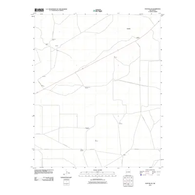
2010 Map of Pastura SE
USGS Topo · Published 2010About this map
Arabella and the surrounding high plains of Guadalupe County are defined by a sparse network of ranching and mining infrastructure in this 2010 survey. The landscape is dotted with named water sources essential for livestock in this arid environment, including the Hobo John Windmill, Lib Windmill, and Little Hamilton Windmill. These features, along with small settlements like Gallegos, Chaves, and Guadalupe, illustrate a land-use pattern centered on scattered outposts and cattle operations. Industrial activity is marked by the Stauber Mine and Guadalupe Mine in the northwestern portion of the map, connected to the broader region by a web of local routes such as County Rd-3. The presence of the Histon Ranch in the south underscores the enduring cattle-ranching heritage that continues to shape this part of New Mexico.
Find a feature on this map
20 named features on this map. Tap any name to fly to it.
Don’t see what you’re looking for? This feature index may not catch every label — zoom into the map to look around manually.
Map Details
Editions of this 2010 Pastura SE Map
This is the sole edition of this map. No revisions or reprints were ever made.
Other maps of this area

1954 · Fort Sumner
USGS Topo · 1:250,000

1958 · Fort Sumner
USGS Topo · 1:250,000

1963 · Santa Rosa
USGS Topo · 1:24,000

1963 · Puerto Creek
USGS Topo · 1:24,000

1966 · Borica
USGS Topo · 1:24,000
1978 · San Ignacio
USGS Topo · 1:24,000
1978 · Pastura NE
USGS Topo · 1:24,000

1978 · Laguna De Los Terreros
USGS Topo · 1:24,000
1978 · Pastura
USGS Topo · 1:24,000

1978 · El Morro Ranch NW
USGS Topo · 1:24,000