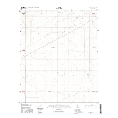
2017 Map of Pastura SE
USGS Topo · Published 2017About this map
Arabella serves as the primary point of settlement in this high-plains landscape of Guadalupe County. The terrain is defined by a network of drainage systems, most notably Arroyo El Ojito in the northwest corner, which shapes the local topography. This area of New Mexico is characterized by its rural road network, where historical land divisions meet modern county maintenance. Names such as Gonzales Rd and Arabella Rd reflect local family lineage and the connection between sparse outposts. The map documents a complex system of county roads, including C O Rd 4MM and various branches of Co Rd 3 D, illustrating how transportation evolved to serve isolated ranching or agricultural tracts across multiple township and range sections.
Find a feature on this map
20 named features on this map. Tap any name to fly to it.
Don’t see what you’re looking for? This feature index may not catch every label — zoom into the map to look around manually.
Map Details
Editions of this 2017 Pastura SE Map
This is the sole edition of this map. No revisions or reprints were ever made.
Other maps of this area

1954 · Fort Sumner
USGS Topo · 1:250,000

1958 · Fort Sumner
USGS Topo · 1:250,000

1963 · Santa Rosa
USGS Topo · 1:24,000

1963 · Puerto Creek
USGS Topo · 1:24,000

1966 · Borica
USGS Topo · 1:24,000
1978 · San Ignacio
USGS Topo · 1:24,000
1978 · Pastura NE
USGS Topo · 1:24,000

1978 · Laguna De Los Terreros
USGS Topo · 1:24,000
1978 · Pastura
USGS Topo · 1:24,000

1978 · El Morro Ranch NW
USGS Topo · 1:24,000