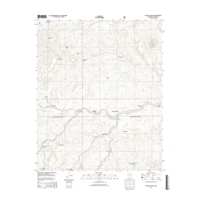
2013 Map of Pasture Canyon
USGS Topo · Published 2013About this map
Cibola National Forest encompasses a significant portion of this landscape, where high-desert canyons and drainage systems define the human footprint. The map documents scattered ranching outposts and isolated structures such as White House Ranch, McCord Place, and Box Bar Place, which are situated along the ephemeral course of Alamosita Cr. These locations, along with the Grapevine Cabin, suggest a history of range management and seasonal habitation in a region where water is a critical resource.
Find a feature on this map
31 named features on this map. Tap any name to fly to it.
Don’t see what you’re looking for? This feature index may not catch every label — zoom into the map to look around manually.
Map Details
Editions of this 2013 Pasture Canyon Map
This is the sole edition of this map. No revisions or reprints were ever made.
Other maps of this area

1917 · Broom Mountain
USGS Topo · 1:125,000

1954 · Socorro
USGS Topo · 1:250,000

1958 · Socorro
USGS Topo · 1:250,000

1962 · Socorro
USGS Topo · 1:250,000

1963 · Cal Ship Mesa
USGS Topo · 1:24,000

1964 · Third Canyon
USGS Topo · 1:24,000

1964 · Wiley Mesa
USGS Topo · 1:24,000

1964 · Dog Springs
USGS Topo · 1:24,000
1964 · Bonine Canyon
USGS Topo · 1:24,000

1964 · Pasture Canyon
USGS Topo · 1:24,000