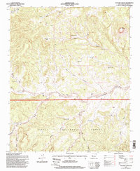
1995 Map of Pasture Canyon
USGS Topo · Published 1998About this map
Cibola National Forest defines this high-desert landscape in Catron County, where water sources and isolated ranches dictate the pattern of human settlement. The drainage of Alamocita Creek serves as a primary corridor through the terrain, flanked by notable landforms such as Bell Mountain and Rock House Canyon. Evidence of late 20th-century ranching and land management is widespread, marked by specific family-named and functional locations like White House Ranch, McCord Place, and Box Bar Place.
Find a feature on this map
28 named features on this map. Tap any name to fly to it.
Don’t see what you’re looking for? This feature index may not catch every label — zoom into the map to look around manually.
Map Details
Editions of this 1995 Pasture Canyon Map
This is the sole edition of this map. No revisions or reprints were ever made.
Other maps of this area

1917 · Broom Mountain
USGS Topo · 1:125,000

1954 · Socorro
USGS Topo · 1:250,000

1958 · Socorro
USGS Topo · 1:250,000

1962 · Socorro
USGS Topo · 1:250,000

1963 · Cal Ship Mesa
USGS Topo · 1:24,000

1964 · Third Canyon
USGS Topo · 1:24,000

1964 · Wiley Mesa
USGS Topo · 1:24,000

1964 · Dog Springs
USGS Topo · 1:24,000
1964 · Bonine Canyon
USGS Topo · 1:24,000

1964 · Pasture Canyon
USGS Topo · 1:24,000