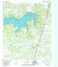
1980 Map of Pat Mayse Lake East
USGS Topo · Published 1986About this map
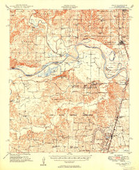
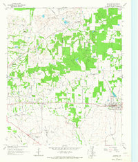
Pat Mayse Lake dominates this 1980 landscape in northern Lamar County, showing the reservoir at an elevation of 451 feet. To the south, the expansive grounds of Camp Maxey reveal a transition from military infrastructure to the surrounding rural countryside. The map documents several small communities and crossroads such as Chicota, Powderly, and Arthur City, which sit near the northern edge by the river. Genealogists will find significant value in the numerous family and community burial grounds, including Littlejohn Cem, Casey Cem, and McEwin Cem, many of which are tucked away from the main thoroughfares.
Find a feature on this map
36 named features on this map. Tap any name to fly to it.
Don’t see what you’re looking for? This feature index may not catch every label — zoom into the map to look around manually.
Map Details
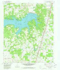
Editions of this 1980 Pat Mayse Lake East Map
2 editions found
Other maps of this area

1903 · Paris
USGS Topo · 1:125,000
1948 · Grant
USGS Topo · 1:62,500
1948 · Paris
USGS Topo · 1:62,500
1949 · Grant
USGS Topo · 1:62,500
1949 · Paris
USGS Topo · 1:62,500
1951 · Slate Shoals
USGS Topo · 1:24,000
1951 · Shoals
USGS Topo · 1:24,000

1953 · Texarkana
USGS Topo · 1:250,000

1956 · Texarkana
USGS Topo · 1:250,000
1964 · Blossom
USGS Topo · 1:24,000